

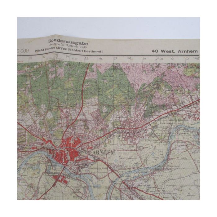

German Military map of Arnhem and Nijmegen 1940
German military map of Arhnem and Nijmegen
Reprint of the actual German military map of the Arnhem and Nijmegen area
Scale 1:50,000
Printed on period aged paper to make it look old .
Size 50 x 70 cms
The map shows the town centres of Arnhem, Nijmegen, Oosterbeek, the drop zones of Wolfhezen, Heelsum, Driel and also the bridges over the River Neder
Map was printed originally in 1940
| Weight (g) | 40.00 |
|---|---|
| Restricted Product? | No |